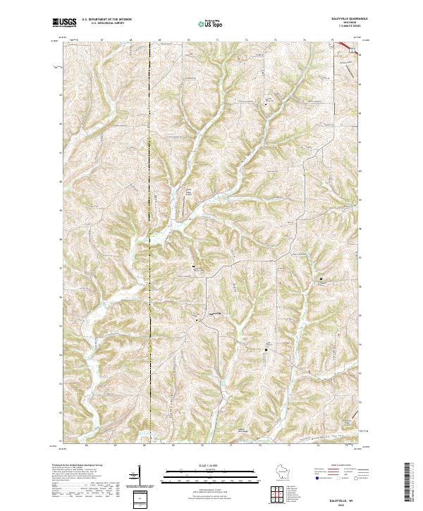
2022 Map of Daleyville
USGS Topo · Published 2022About this map
The unincorporated settlement of Daleyville serves as the focal point for this landscape, where the Iowa Co Dane Co boundary line cuts through the rolling topography of southwestern Wisconsin. The area is defined by a series of prominent drainage basins and ridges, including German Valley, Drammen Valley, and Indian Hill Ridge, which have influenced the local road network and settlement patterns for generations. A high density of rural cemeteries, such as the Perry Lutheran Cem, Hauge Lutheran Cem, and the Hauge Log Church Cem, speaks to the deep-rooted Norwegian-American heritage and community life in this portion of the Driftless Area. Two small aviation facilities, Atkins Ridge Airport and Cardinal Ridge Airport, appear among the ridges, while the headwaters of Gordon Cr and Kittleson Valley Cr weave between the family-named farm roads that crisscross the county line.
Find a feature on this map
66 named features on this map. Tap any name to fly to it.
Don’t see what you’re looking for? This feature index may not catch every label — zoom into the map to look around manually.
Map Details
Editions of this 2022 Daleyville Map
This is the sole edition of this map. No revisions or reprints were ever made.
Other maps of this area

1907 · Cross Plains
USGS Topo · 1:62,500

1909 · Cross Plains
USGS Topo · 1:62,500

1920 · Blue Mounds
USGS Topo · 1:62,500

1922 · Blue Mounds
USGS Topo · 1:62,500

1923 · Blanchardville
USGS Topo · 1:62,500

1923 · New Glarus
USGS Topo · 1:62,500

1954 · Rockford
USGS Topo · 1:250,000

1955 · Rockford
USGS Topo · 1:250,000

1957 · Madison
USGS Topo · 1:250,000

1958 · Rockford
USGS Topo · 1:250,000