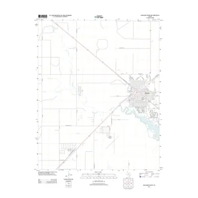
2012 Map of Dalhart West
USGS Topo · Published 2012About this map
Dalhart serves as the focal point of this Panhandle landscape, where the grid-iron street pattern of the town meets the open High Plains. The drainage of Rita Blanca Cr and Carrizo Cr converges southwest of the town center, feeding into the waters of Rita Blanca Lake. This geography highlights the critical importance of water management in a semi-arid region, evidenced by the proximity of these watercourses to the primary settlement and transportation corridors. The transportation network is a mixture of long-distance routes like N Amarillo St and local rural connections such as John Deere Rd and Nortex Rd. To the south, the Dalhart Municipal Airport stands as a key infrastructure point, while the town's residential and commercial expansion is traced through thoroughfares like Denrock Ave and Chicago St.
Find a feature on this map
61 named features on this map. Tap any name to fly to it.
Don’t see what you’re looking for? This feature index may not catch every label — zoom into the map to look around manually.
Map Details
Editions of this 2012 Dalhart West Map
This is the sole edition of this map. No revisions or reprints were ever made.
Other maps of this area

1954 · Tucumcari
USGS Topo · 1:250,000

1954 · Dalhart
USGS Topo · 1:250,000

1958 · Tucumcari
USGS Topo · 1:250,000

1958 · Dalhart
USGS Topo · 1:250,000

1962 · Dalhart
USGS Topo · 1:250,000

1973 · Pardue Camp
USGS Topo · 1:24,000

1973 · Hartley
USGS Topo · 1:24,000

1973 · King
USGS Topo · 1:24,000

1973 · Canyon School
USGS Topo · 1:24,000

1973 · Bolin NE
USGS Topo · 1:24,000