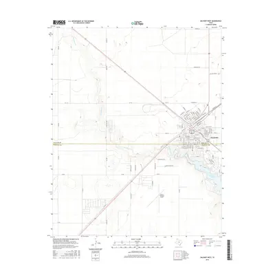
2016 Map of Dalhart West
USGS Topo · Published 2016About this map
Dalhart straddles the high plains border of the Texas Panhandle, positioned precisely on the boundary line between Dallam Co and Hartley Co. This modern survey illustrates the community's expansion westward toward the breaks of Rita Blanca Cr, which feeds into the prominent Rita Blanca Lake south of the city center. The landscape is defined by the rigid grid of the Llano Estacado, where agricultural roads like Nortex Rd and Mackey Rd intersect with regional thoroughfares including FM 1727 and FM 694. Significant infrastructure is concentrated on the town's periphery, notably the Dalhart Municipal Airport and residential developments such as Pioneer Estates Rd and Green Acres Ln, while drainage from Carrizo Cr carves distinct topography into the otherwise flat terrain.
Find a feature on this map
94 named features on this map. Tap any name to fly to it.
Don’t see what you’re looking for? This feature index may not catch every label — zoom into the map to look around manually.
Map Details
Editions of this 2016 Dalhart West Map
This is the sole edition of this map. No revisions or reprints were ever made.
Other maps of this area

1954 · Tucumcari
USGS Topo · 1:250,000

1954 · Dalhart
USGS Topo · 1:250,000

1958 · Tucumcari
USGS Topo · 1:250,000

1958 · Dalhart
USGS Topo · 1:250,000

1962 · Dalhart
USGS Topo · 1:250,000

1973 · Pardue Camp
USGS Topo · 1:24,000

1973 · Hartley
USGS Topo · 1:24,000

1973 · King
USGS Topo · 1:24,000

1973 · Canyon School
USGS Topo · 1:24,000

1973 · Bolin NE
USGS Topo · 1:24,000