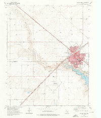
1973 Map of Dalhart West
USGS Topo · Published 1976About this map
The High Plains city of Dalhart straddles the county line between Dallam Co and Hartley Co, functioning as a vital transportation hub in the Texas Panhandle. This mid-1970s survey captures the convergence of major rail corridors, specifically the Fort Worth and Denver and the Chicago Rock Island and Pacific lines, which dictate the town's diagonal grid and industrial footprint. The landscape is defined by the winding course of Rita Blanca Creek, which feeds into a large Lake south of the city center.
Find a feature on this map
27 named features on this map. Tap any name to fly to it.
Don’t see what you’re looking for? This feature index may not catch every label — zoom into the map to look around manually.
Map Details
Editions of this 1973 Dalhart West Map
This is the sole edition of this map. No revisions or reprints were ever made.
Other maps of this area

1954 · Tucumcari
USGS Topo · 1:250,000

1954 · Dalhart
USGS Topo · 1:250,000

1958 · Tucumcari
USGS Topo · 1:250,000

1958 · Dalhart
USGS Topo · 1:250,000

1962 · Dalhart
USGS Topo · 1:250,000

1973 · Pardue Camp
USGS Topo · 1:24,000

1973 · Hartley
USGS Topo · 1:24,000

1973 · King
USGS Topo · 1:24,000

1973 · Canyon School
USGS Topo · 1:24,000

1973 · Bolin NE
USGS Topo · 1:24,000