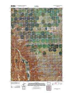
2011 Map of Dalreed Butte
USGS Topo · Published 2011About this map
Dalreed Butte stands as a prominent landmark in this section of Gilliam County, anchoring a landscape shaped by both natural drainage and modern aerospace industry. The presence of the Boeing Test Site north of Schoolhouse Canyon indicates the area's role in large-scale technological development during the early 21st century. Water management is central to the local geography, with the winding course of Willow Creek and the man-made Ewing Ditch following the natural contours of the basin. The road network, featuring names like Immigrant Ln and Fairview Ln, suggests a history of passage and settlement across these high plains. This 2011 survey captures the intersection of traditional agricultural irrigation and high-tech testing facilities in the high desert of Oregon.
Find a feature on this map
9 named features on this map. Tap any name to fly to it.
Don’t see what you’re looking for? This feature index may not catch every label — zoom into the map to look around manually.
Map Details
Editions of this 2011 Dalreed Butte Map
This is the sole edition of this map. No revisions or reprints were ever made.
Other maps of this area

1906 · Blalock Island
USGS Topo · 1:125,000

1908 · Blalock Island
USGS Topo · 1:125,000

1916 · Arlington
USGS Topo · 1:125,000

1953 · Pendleton
USGS Topo · 1:250,000

1953 · The Dalles
USGS Topo · 1:250,000

1956 · The Dalles
USGS Topo · 1:250,000

1956 · Pendleton
USGS Topo · 1:250,000

1957 · The Dalles
USGS Topo · 1:250,000

1962 · Alderdale
USGS Topo · 1:24,000

1962 · Heppner Junction
USGS Topo · 1:24,000