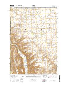
2017 Map of Dalreed Butte
USGS Topo · Published 2017About this map
Dalreed Butte rises as a prominent landmark in this high plateau region of North Central Oregon, marking a landscape defined by deep drainages and agricultural land. The transition between Gilliam and Morrow counties is clearly delineated across a terrain carved by Schoolhouse Canyon and the valley of Willow Creek. This 2017 survey details the complex network of water management and local transit essential to the area's ranching and farming operations. Traceable features like the Ewing Ditch illustrate the historical and ongoing efforts to direct water through the arid hills, while named routes such as Immigrant Ln and Threemile Rd provide clues to early settlement patterns and the movement of goods across the county line.
Find a feature on this map
15 named features on this map. Tap any name to fly to it.
Don’t see what you’re looking for? This feature index may not catch every label — zoom into the map to look around manually.
Map Details
Editions of this 2017 Dalreed Butte Map
This is the sole edition of this map. No revisions or reprints were ever made.
Other maps of this area

1906 · Blalock Island
USGS Topo · 1:125,000

1908 · Blalock Island
USGS Topo · 1:125,000

1916 · Arlington
USGS Topo · 1:125,000

1953 · Pendleton
USGS Topo · 1:250,000

1953 · The Dalles
USGS Topo · 1:250,000

1956 · The Dalles
USGS Topo · 1:250,000

1956 · Pendleton
USGS Topo · 1:250,000

1957 · The Dalles
USGS Topo · 1:250,000

1962 · Alderdale
USGS Topo · 1:24,000

1962 · Heppner Junction
USGS Topo · 1:24,000