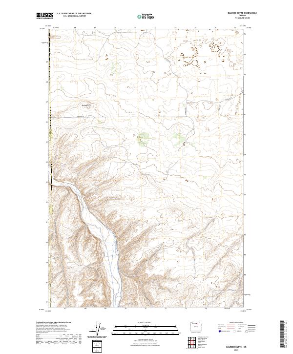
2023 Map of Dalreed Butte
USGS Topo · Published 2023About this map
Dalreed Butte rises as a prominent landmark in this section of the Oregon high desert, where the landscape is defined by deep drainages and agricultural infrastructure. The southwestern corner of the sheet is marked by the steep descent into Schoolhouse Canyon, a name that suggests the former locations of rural community centers in this sparsely populated region. Water management is central to the area's geography, evidenced by the course of Willow Creek and the man-made Ewing Ditch winding through the valley floors.
Find a feature on this map
12 named features on this map. Tap any name to fly to it.
Don’t see what you’re looking for? This feature index may not catch every label — zoom into the map to look around manually.
Map Details
Editions of this 2023 Dalreed Butte Map
This is the sole edition of this map. No revisions or reprints were ever made.
Other maps of this area

1906 · Blalock Island
USGS Topo · 1:125,000

1908 · Blalock Island
USGS Topo · 1:125,000

1916 · Arlington
USGS Topo · 1:125,000

1953 · Pendleton
USGS Topo · 1:250,000

1953 · The Dalles
USGS Topo · 1:250,000

1956 · The Dalles
USGS Topo · 1:250,000

1956 · Pendleton
USGS Topo · 1:250,000

1957 · The Dalles
USGS Topo · 1:250,000

1962 · Alderdale
USGS Topo · 1:24,000

1962 · Heppner Junction
USGS Topo · 1:24,000