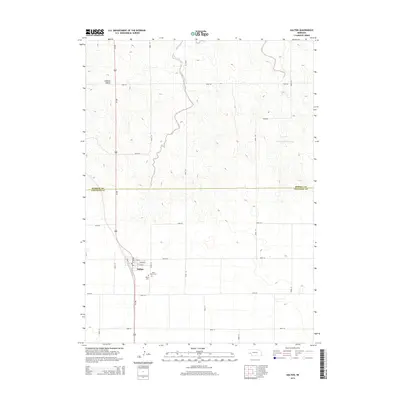
2014 Map of Dalton
USGS Topo · Published 2014About this map
The high plains of the Nebraska Panhandle are anchored by Dalton, where the intersection of Us-385 and a grid of rural county roads organizes the agricultural landscape. This survey highlights the community's local heritage through the presence of Dalton Cem and Saint Marys Cem situated just east of the main town site. The terrain is defined by wide open spaces and subtle elevation changes, most notably at Lookout Mound in the northwest and the depression of Camp Creek Reservoir to the east. The map captures the boundary between Morrill Co and Cheyenne Co, illustrating the precise section-line property divisions that have dictated land use in this region for over a century. A detailed street plan of the village core includes namesake thoroughfares such as Main St, Broad St, and Francis St, providing a clear view of the town's compact residential and commercial footprint.
Find a feature on this map
25 named features on this map. Tap any name to fly to it.
Don’t see what you’re looking for? This feature index may not catch every label — zoom into the map to look around manually.
Map Details
Editions of this 2014 Dalton Map
This is the sole edition of this map. No revisions or reprints were ever made.
Other maps of this area

1896 · Browns Creek
USGS Topo · 1:125,000

1898 · Camp Clarke
USGS Topo · 1:125,000

1899 · Browns Creek
USGS Topo · 1:125,000

1899 · Sidney
USGS Topo · 1:125,000

1954 · Scottsbluff
USGS Topo · 1:250,000

1958 · Scottsbluff
USGS Topo · 1:250,000

1965 · Broadwater
USGS Topo · 1:24,000

1965 · Courthouse Rock
USGS Topo · 1:24,000

1965 · Broadwater SW
USGS Topo · 1:24,000

1972 · Gurley
USGS Topo · 1:24,000