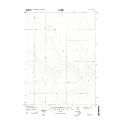
2014 Map of Dalton SE
USGS Topo · Published 2014About this map
Rush Cr carves a winding path through this corner of Cheyenne County, creating a series of intricate breaks and draws in the High Plains landscape. The area is defined by a rigid grid of local thoroughfares, from Road 125 on the western edge to Road 135 in the east, reflecting the systematic land division typical of Nebraska's agricultural heartland. These routes, including Road 50 and Road 38, provide the primary structure for the rural landscape, connecting isolated farmsteads across the undulating terrain. The topographic detail highlights the transition from level upland plateaus to the eroded drainage basins surrounding the creek, where the elevation changes become more pronounced. This 2014 survey preserves the functional geography of a region where water and road access dictate the pattern of human presence.
Find a feature on this map
16 named features on this map. Tap any name to fly to it.
Don’t see what you’re looking for? This feature index may not catch every label — zoom into the map to look around manually.
Map Details
Editions of this 2014 Dalton SE Map
This is the sole edition of this map. No revisions or reprints were ever made.
Other maps of this area

1899 · Sidney
USGS Topo · 1:125,000

1954 · Scottsbluff
USGS Topo · 1:250,000

1958 · Scottsbluff
USGS Topo · 1:250,000

1972 · Lisco NW
USGS Topo · 1:24,000

1972 · Gurley
USGS Topo · 1:24,000
1972 · Fairchild Ranch
USGS Topo · 1:24,000

1972 · Lodgepole
USGS Topo · 1:24,000

1972 · Lisco SW
USGS Topo · 1:24,000
1972 · Dalton
USGS Topo · 1:24,000

1972 · Sunol
USGS Topo · 1:24,000