
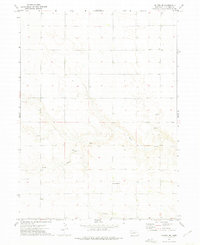
1972 Map of Lodgepole
USGS Topo · Published 1975About this map
Lodgepole serves as the focal point of this high-plains landscape in Cheyenne County, where the Union Pacific railroad and the waters of Lodgepole Creek run parallel through the valley. The settlement layout reflects the critical role of the rail line, with infrastructure like a Water Tank and a nearby Landing Strip with its associated Beacon marking the intersection of ground and air transport in the early 1970s.
Find a feature on this map
11 named features on this map. Tap any name to fly to it.
Don’t see what you’re looking for? This feature index may not catch every label — zoom into the map to look around manually.
Map Details
Editions of this 1972 Lodgepole Map
This is the sole edition of this map. No revisions or reprints were ever made.
Other maps of this area

1899 · Sidney
USGS Topo · 1:125,000

1954 · Scottsbluff
USGS Topo · 1:250,000

1958 · Scottsbluff
USGS Topo · 1:250,000

1972 · Lisco SW
USGS Topo · 1:24,000
1972 · Lodgepole SE
USGS Topo · 1:24,000
1972 · Lodgepole SW
USGS Topo · 1:24,000
1972 · Lisco SE
USGS Topo · 1:24,000
1972 · Mount Vernon
USGS Topo · 1:24,000

1972 · Sunol
USGS Topo · 1:24,000
1972 · Dalton SE
USGS Topo · 1:24,000