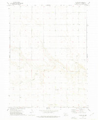
1972 Map of Dalton SE
USGS Topo · Published 1975About this map
Rush Creek meanders through this section of Cheyenne County, Nebraska, cutting a distinct valley through the high plains landscape as recorded in 1972. The map reveals a rural economy focused on resource extraction and infrastructure, evidenced by multiple Gravel Pits and an Oil Well scattered across the township lines. Educational and agricultural centers like Grand Prairie Sch serve the surrounding farmsteads, while the small settlement of Spearow and the Miller property anchor the local community. A large Tank Farm in the western portion of the quadrangle highlights the intersection of industrial storage and the expansive open range. This survey provides a precise look at the land use patterns and property divisions at the boundary of Range 48 West and Range 47 West during the early 1970s.
Find a feature on this map
9 named features on this map. Tap any name to fly to it.
Don’t see what you’re looking for? This feature index may not catch every label — zoom into the map to look around manually.
Map Details
Editions of this 1972 Dalton SE Map
This is the sole edition of this map. No revisions or reprints were ever made.
Other maps of this area

1899 · Sidney
USGS Topo · 1:125,000

1954 · Scottsbluff
USGS Topo · 1:250,000

1958 · Scottsbluff
USGS Topo · 1:250,000

1972 · Lisco NW
USGS Topo · 1:24,000

1972 · Gurley
USGS Topo · 1:24,000
1972 · Fairchild Ranch
USGS Topo · 1:24,000

1972 · Lodgepole
USGS Topo · 1:24,000

1972 · Lisco SW
USGS Topo · 1:24,000
1972 · Dalton
USGS Topo · 1:24,000

1972 · Sunol
USGS Topo · 1:24,000