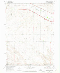
1972 Map of Lodgepole SE
USGS Topo · Published 1975About this map
The high plains of the Nebraska-Colorado border define this 1972 landscape, where the Union Pacific railroad and Interstate 80 run parallel across the northern tier. This corridor follows the natural path of Lodgepole Creek, which winds through the terrain near the small St Joseph Cem. The southern portion of the map transitions into more dissected topography, characterized by the seasonal drainages of Sedgwick Draw and Sand Draw as they cut through the rural borderlands of Deuel and Sedgwick counties. While much of the land remains open and agricultural, local industrial activity is noted at a Gravel Pit near the center of the sheet. The survey captures a moment of modern transit development, including a designated Rest Area along the interstate, set against the older, permanent landmarks of the railroad and the state boundary line.
Find a feature on this map
13 named features on this map. Tap any name to fly to it.
Don’t see what you’re looking for? This feature index may not catch every label — zoom into the map to look around manually.
Map Details
Editions of this 1972 Lodgepole SE Map
This is the sole edition of this map. No revisions or reprints were ever made.
Other maps of this area

1899 · Sidney
USGS Topo · 1:125,000

1900 · Chappell
USGS Topo · 1:125,000

1953 · Ovid
USGS Topo · 1:24,000

1953 · Julesburg Reservoir
USGS Topo · 1:24,000

1953 · Sedgwick
USGS Topo · 1:24,000

1954 · Sterling
USGS Topo · 1:250,000

1954 · Scottsbluff
USGS Topo · 1:250,000

1958 · Scottsbluff
USGS Topo · 1:250,000

1958 · Sterling
USGS Topo · 1:250,000

1961 · Chappell
USGS Topo · 1:24,000