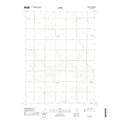
2017 Map of Dalton SE
USGS Topo · Published 2017About this map
Rush Cr meanders through the southern half of this High Plains landscape in Cheyenne County, providing a natural drainage break in an otherwise highly organized agricultural grid. The map reveals a strictly regulated section-line road system, where routes like Rd 135 and Rd 127 facilitate movement across the open prairie. This 2017 edition illustrates the enduring township-and-range structure, specifically within t16n r48w and t15n r48w, where the intersection of roads such as Rd 50 and RD 131 marks the steady rhythm of rural Nebraska life. The topography is defined by subtle elevation shifts and seasonal wetlands, highlighting the importance of the intermittent water flow of Rush Cr to the local environment and land management.
Find a feature on this map
19 named features on this map. Tap any name to fly to it.
Don’t see what you’re looking for? This feature index may not catch every label — zoom into the map to look around manually.
Map Details
Editions of this 2017 Dalton SE Map
This is the sole edition of this map. No revisions or reprints were ever made.
Other maps of this area

1899 · Sidney
USGS Topo · 1:125,000

1954 · Scottsbluff
USGS Topo · 1:250,000

1958 · Scottsbluff
USGS Topo · 1:250,000

1972 · Lisco NW
USGS Topo · 1:24,000

1972 · Gurley
USGS Topo · 1:24,000
1972 · Fairchild Ranch
USGS Topo · 1:24,000

1972 · Lodgepole
USGS Topo · 1:24,000

1972 · Lisco SW
USGS Topo · 1:24,000
1972 · Dalton
USGS Topo · 1:24,000

1972 · Sunol
USGS Topo · 1:24,000