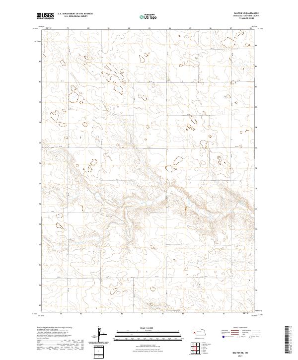
2021 Map of Dalton SE
USGS Topo · Published 2021About this map
Rush Cr meanders across the southern half of this landscape, carving a subtle drainage pattern through the high plains of Cheyenne County. The terrain is defined by a rigorous grid of section lines and rural thoroughfares, including RD 50 and RD 125, which organize the agricultural workspace of the Nebraska panhandle. This 2021 survey illustrates the modern persistence of the Public Land Survey System, with township boundaries for t16n r48w and t15n r48w clearly delineating the vast, open acreage characteristic of the region. The map reveals the relationship between natural watercourses and the human-imposed geometry of the road network, highlighting how RD 38 and RD 44 navigate the gentle rises and depressions of the prairie floor.
Find a feature on this map
19 named features on this map. Tap any name to fly to it.
Don’t see what you’re looking for? This feature index may not catch every label — zoom into the map to look around manually.
Map Details
Editions of this 2021 Dalton SE Map
This is the sole edition of this map. No revisions or reprints were ever made.
Other maps of this area

1899 · Sidney
USGS Topo · 1:125,000

1954 · Scottsbluff
USGS Topo · 1:250,000

1958 · Scottsbluff
USGS Topo · 1:250,000

1972 · Lisco NW
USGS Topo · 1:24,000

1972 · Gurley
USGS Topo · 1:24,000
1972 · Fairchild Ranch
USGS Topo · 1:24,000

1972 · Lodgepole
USGS Topo · 1:24,000

1972 · Lisco SW
USGS Topo · 1:24,000
1972 · Dalton
USGS Topo · 1:24,000

1972 · Sunol
USGS Topo · 1:24,000