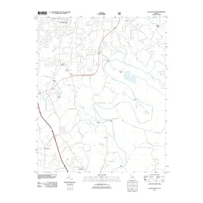
2011 Map of Dalton South
USGS Topo · Published 2011About this map
Crown Mill Village and the industrial corridors south of Dalton anchor this 2011 survey, showing a landscape where residential pockets and manufacturing sites meet the winding path of the Conasauga River. The map highlights several smaller communities and rural junctions, including Five Springs, Phelps, and Tilton, each connected by a network of local roads such as Old Tilton Rd SE and Hickory Flats Rd SE. Historical continuity is evident in the preservation of several family and community burial grounds, such as Camp Lewallen Cemetery and Henton Cemetery.
Find a feature on this map
84 named features on this map. Tap any name to fly to it.
Don’t see what you’re looking for? This feature index may not catch every label — zoom into the map to look around manually.
Map Details
Editions of this 2011 Dalton South Map
This is the sole edition of this map. No revisions or reprints were ever made.
Other maps of this area

1886 · Dalton
USGS Topo · 1:125,000

1886 · Ringgold
USGS Topo · 1:125,000

1892 · Ringgold
USGS Topo · 1:125,000

1892 · Dalton
USGS Topo · 1:125,000

1897 · Dalton
USGS Topo · 1:125,000

1935 · Villanow
USGS Topo · 1:24,000

1935 · Tunnel Hill
USGS Topo · 1:24,000

1938 · Chatsworth
USGS Topo · 1:48,000

1943 · Dalton
USGS Topo · 1:62,500
1943 · Tunnel Hill
USGS Topo · 1:24,000