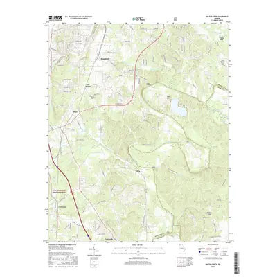
2017 Map of Dalton South
USGS Topo · Published 2017About this map
Dalton serves as the focal point of this 2017 survey, where industrial and suburban expansion meets the winding course of the Conasauga River. This landscape is defined by its water-driven history, evidenced by Crown Mill Lake and the prominent Keiths Mill in the northeastern corner. The map traces the transition from the city's built environment to the protected timberlands of the Chattahoochee National Forest in the southwest.
Find a feature on this map
123 named features on this map. Tap any name to fly to it.
Don’t see what you’re looking for? This feature index may not catch every label — zoom into the map to look around manually.
Map Details
Editions of this 2017 Dalton South Map
This is the sole edition of this map. No revisions or reprints were ever made.
Other maps of this area

1886 · Dalton
USGS Topo · 1:125,000

1886 · Ringgold
USGS Topo · 1:125,000

1892 · Ringgold
USGS Topo · 1:125,000

1892 · Dalton
USGS Topo · 1:125,000

1897 · Dalton
USGS Topo · 1:125,000

1935 · Villanow
USGS Topo · 1:24,000

1935 · Tunnel Hill
USGS Topo · 1:24,000

1938 · Chatsworth
USGS Topo · 1:48,000

1943 · Dalton
USGS Topo · 1:62,500
1943 · Tunnel Hill
USGS Topo · 1:24,000