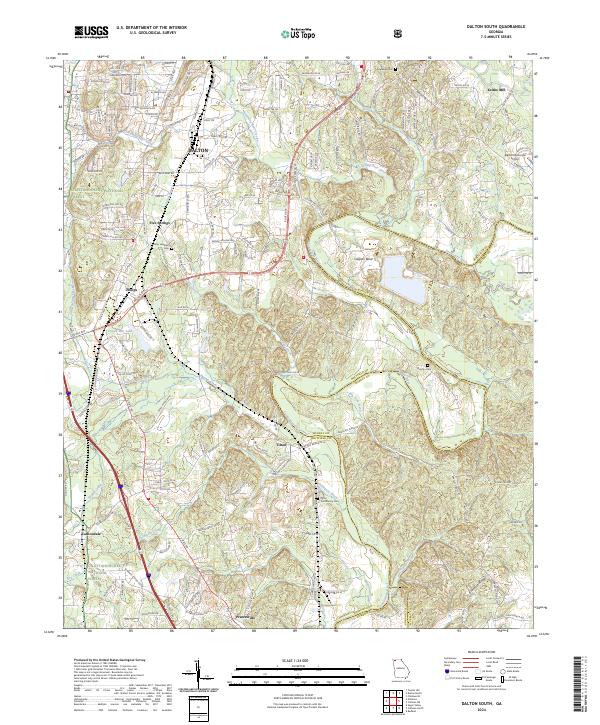
2024 Map of Dalton South
USGS Topo · Published 2024About this map
The Conasauga River carves a winding path through the eastern half of this terrain, defining the boundary between Whitfield and Murray counties. This area south of Dalton shows a landscape defined by water and transit, with numerous creeks like Swamp Creek and Thomason Creek feeding into the larger river system. The presence of Keiths Mill in the northeast and small clusters of community life at Five Springs, Tilton, and Phelps suggest a historical reliance on these waterways and the CSX railroad corridor for commerce and movement.
Find a feature on this map
157 named features on this map. Tap any name to fly to it.
Don’t see what you’re looking for? This feature index may not catch every label — zoom into the map to look around manually.
Map Details
Editions of this 2024 Dalton South Map
This is the sole edition of this map. No revisions or reprints were ever made.
Other maps of this area

1886 · Dalton
USGS Topo · 1:125,000

1886 · Ringgold
USGS Topo · 1:125,000

1892 · Ringgold
USGS Topo · 1:125,000

1892 · Dalton
USGS Topo · 1:125,000

1897 · Dalton
USGS Topo · 1:125,000

1935 · Villanow
USGS Topo · 1:24,000

1935 · Tunnel Hill
USGS Topo · 1:24,000

1938 · Chatsworth
USGS Topo · 1:48,000

1943 · Dalton
USGS Topo · 1:62,500
1943 · Tunnel Hill
USGS Topo · 1:24,000