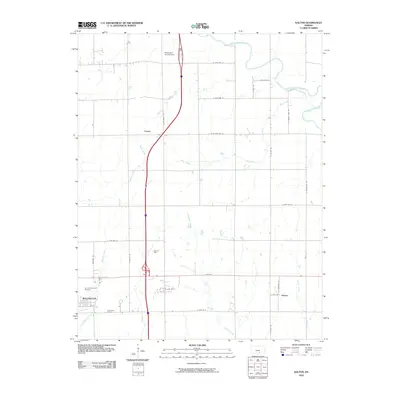
2010 Map of Dalton
USGS Topo · Published 2010About this map
Wellington sits at the southwestern edge of this landscape, where the local economy transitions into energy production and agriculture. The eastern portion of the city gives way to the Interchange Oil Field, while further north, the Rusk Oil Field borders the path of Dear Creek. The terrain is defined by a dendritic drainage pattern typical of the Kansas plains, with Antelope Creek and Hargis Creek carving shallow paths through the grid-work of section-line roads. Small rural communities like Cicero and Dalton serve as landmarks in the outlying areas, while the Ninnescah River meanders across the northern reaches. This 2010 survey illustrates the modernization of the corridor, including the Wellington Service Area along the interstate and the established grounds of Sumner Memorial Gardens.
Find a feature on this map
36 named features on this map. Tap any name to fly to it.
Don’t see what you’re looking for? This feature index may not catch every label — zoom into the map to look around manually.
Map Details
Editions of this 2010 Dalton Map
This is the sole edition of this map. No revisions or reprints were ever made.
Other maps of this area

1890 · Wellington
USGS Topo · 1:125,000

1955 · Belle Plaine
USGS Topo · 1:24,000
1955 · Zyba
USGS Topo · 1:24,000

1955 · Mulvane
USGS Topo · 1:24,000

1955 · Wichita
USGS Topo · 1:250,000

1958 · Wichita
USGS Topo · 1:250,000

1964 · South Haven NE
USGS Topo · 1:24,000

1964 · Dalton
USGS Topo · 1:24,000

1965 · Adamsville
USGS Topo · 1:24,000

1965 · Rome
USGS Topo · 1:24,000