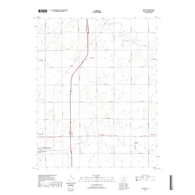
2018 Map of Dalton
USGS Topo · Published 2018About this map
Wellington sits at the southwestern edge of this survey, where the grid of city streets meets the expansive agricultural landscape of Sumner County. The area is defined by a dense network of sectional roads and the meandering paths of several waterways, including Beaver Cr and Hargis Cr, which drain toward the larger Ninnescah River in the north. The small community of Dalton serves as a local landmark in the eastern portion of the map, while the settlement of Cicero is situated near the center, highlighting the rural spacing of early 21st-century Kansas hamlets.
Find a feature on this map
44 named features on this map. Tap any name to fly to it.
Don’t see what you’re looking for? This feature index may not catch every label — zoom into the map to look around manually.
Map Details
Editions of this 2018 Dalton Map
This is the sole edition of this map. No revisions or reprints were ever made.
Other maps of this area

1890 · Wellington
USGS Topo · 1:125,000

1955 · Belle Plaine
USGS Topo · 1:24,000
1955 · Zyba
USGS Topo · 1:24,000

1955 · Mulvane
USGS Topo · 1:24,000

1955 · Wichita
USGS Topo · 1:250,000

1958 · Wichita
USGS Topo · 1:250,000

1964 · South Haven NE
USGS Topo · 1:24,000

1964 · Dalton
USGS Topo · 1:24,000

1965 · Adamsville
USGS Topo · 1:24,000

1965 · Rome
USGS Topo · 1:24,000