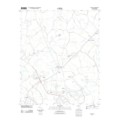
2011 Map of Dalzell
USGS Topo · Published 2011About this map
Dalzell serves as a central hub in this coastal plain landscape, where the Dalzell Post Office and nearby residential areas like Pecan Acres cluster along the local road network. The map reveals a transition from these developed pockets to a hydraulic environment dominated by low-lying wetlands and managed water bodies. Significant drainages like Lee Swamp and Green Swamp converge in the south, while further north, the terrain is punctuated by small-scale impoundments such as Barnett Pond and Ardis Pond, each noted with specific dam records from the 1970s.
Find a feature on this map
110 named features on this map. Tap any name to fly to it.
Don’t see what you’re looking for? This feature index may not catch every label — zoom into the map to look around manually.
Map Details
Editions of this 2011 Dalzell Map
This is the sole edition of this map. No revisions or reprints were ever made.
Other maps of this area

1938 · Hagood
USGS Topo · 1:62,500

1941 · Spartanburg
USGS Topo · 1:250,000

1942 · Camden
USGS Topo · 1:125,000

1943 · Eastover
USGS Topo · 1:62,500

1946 · Sumter
USGS Topo · 1:62,500

1953 · Camden South
USGS Topo · 1:24,000

1953 · Wedgefield
USGS Topo · 1:24,000

1953 · Rembert
USGS Topo · 1:24,000

1953 · Spartanburg
USGS Topo · 1:250,000

1954 · Augusta
USGS Topo · 1:250,000