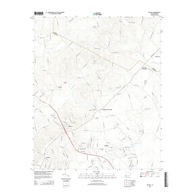
2014 Map of Dalzell
USGS Topo · Published 2014About this map
Dalzell and the surrounding coastal plain of the South Carolina Midlands are defined by a complex network of wetlands and small agricultural communities. This 2014 survey captures the landscape where the border between Lee and Sumter counties follows the natural drainage of Rocky Bluff Swamp and Little Rafting Cr. These watercourses, including Green Swamp and Lee Swamp, historically dictated the placement of crossroads and homesteads, leading to the development of settlements like Borden, Woodrow, and Gaillard Crossroads. Local history is anchored by sites such as Elizabeth Cem and Mt Carmel Cem, which serve as permanent markers of long-standing community roots. The map shows a transition from the structured residential clusters of Pecan Acres and Hillcrest to the more open, creek-fed terrain near Catchall and Burrows Crossroads, illustrating how modern infrastructure continues to navigate the ancient hydrologic patterns of the region.
Find a feature on this map
136 named features on this map. Tap any name to fly to it.
Don’t see what you’re looking for? This feature index may not catch every label — zoom into the map to look around manually.
Map Details
Editions of this 2014 Dalzell Map
This is the sole edition of this map. No revisions or reprints were ever made.
Other maps of this area

1938 · Hagood
USGS Topo · 1:62,500

1941 · Spartanburg
USGS Topo · 1:250,000

1942 · Camden
USGS Topo · 1:125,000

1943 · Eastover
USGS Topo · 1:62,500

1946 · Sumter
USGS Topo · 1:62,500

1953 · Camden South
USGS Topo · 1:24,000

1953 · Wedgefield
USGS Topo · 1:24,000

1953 · Rembert
USGS Topo · 1:24,000

1953 · Spartanburg
USGS Topo · 1:250,000

1954 · Augusta
USGS Topo · 1:250,000