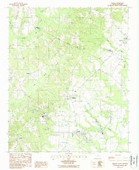
1988 Map of Dalzell
USGS Topo · Published 1988About this map
Dalzell and the surrounding coastal plain of the South Carolina Midlands are captured here during the late 1980s. The landscape is defined by its drainages, where the Lee Co and Sumter Co line traverses a network of wetlands including Rocky Bluff Swamp and Lee Swamp. Small settlements and crossroads serve as the primary landmarks, from the clusters at Hillcrest and Borden to the more dispersed homes at Bracey and Catchall.
Find a feature on this map
20 named features on this map. Tap any name to fly to it.
Don’t see what you’re looking for? This feature index may not catch every label — zoom into the map to look around manually.
Map Details
Editions of this 1988 Dalzell Map
This is the sole edition of this map. No revisions or reprints were ever made.
Other maps of this area

1938 · Hagood
USGS Topo · 1:62,500

1941 · Spartanburg
USGS Topo · 1:250,000

1942 · Camden
USGS Topo · 1:125,000

1943 · Eastover
USGS Topo · 1:62,500

1946 · Sumter
USGS Topo · 1:62,500

1953 · Camden South
USGS Topo · 1:24,000

1953 · Wedgefield
USGS Topo · 1:24,000

1953 · Rembert
USGS Topo · 1:24,000

1953 · Spartanburg
USGS Topo · 1:250,000

1954 · Augusta
USGS Topo · 1:250,000