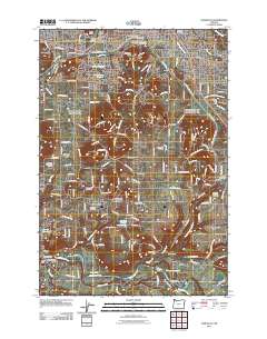
2011 Map of Damascus
USGS Topo · Published 2011About this map
The Clackamas River carves through the southern landscape, defining a region where early pioneer history meets modern suburban expansion. Significant historical markers include the Baker Cabin and the site of Burgherdts Mill, reflecting the area's 19th-century industrial and settlement roots. The map reveals a dense network of local genealogy, featuring numerous burial grounds such as Damascus Cemetery, Gresham Pioneer Cemetery, and Saint Joseph Cemetery. The transformation of the landscape is evident in the Springwater Corridor, a former rail line turned trail that winds through the terrain from Linnemann past Hillsview and Haley. This transition from rural outposts like Boring and Carver to the growing residential fringes of Gresham and Damascus is punctuated by physical landmarks like Gresham Butte and Damascus Heights. Along the river, features like McMurray Ferry and Barton Bridge highlight the historical importance of waterway crossings in Clackamas County.
Find a feature on this map
115 named features on this map. Tap any name to fly to it.
Don’t see what you’re looking for? This feature index may not catch every label — zoom into the map to look around manually.
Map Details
Editions of this 2011 Damascus Map
This is the sole edition of this map. No revisions or reprints were ever made.
Other maps of this area

1897 · Portland
USGS Topo · 1:62,500

1905 · Portland
USGS Topo · 1:62,500

1911 · Boring
USGS Topo · 1:48,000

1914 · Boring
USGS Topo · 1:62,500

1914 · Oregon City
USGS Topo · 1:62,500

1916 · Estacada
USGS Topo · 1:125,000

1918 · Troutdale
USGS Topo · 1:62,500

1934 · Troutdale
USGS Topo · 1:48,000

1939 · Oregon City
USGS Topo · 1:62,500

1940 · Boring
USGS Topo · 1:62,500