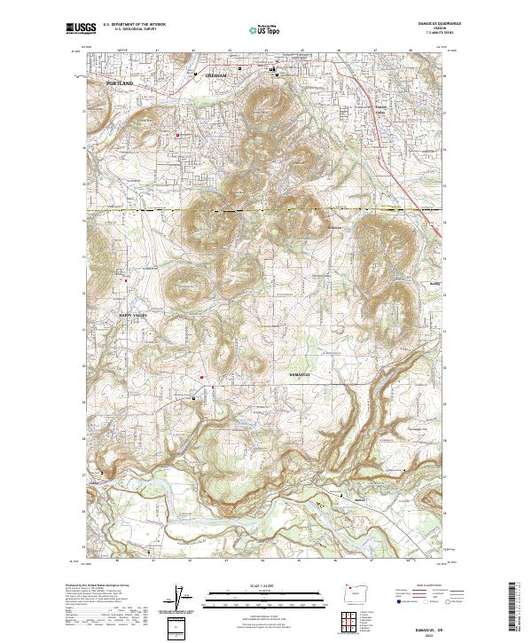
2023 Map of Damascus
USGS Topo · Published 2023About this map
Damascus and its surrounding uplands appear here in a landscape of rolling buttes and branching creek systems where the borders of Multnomah and Clackamas counties meet. The terrain is defined by a series of prominent elevations, including Gresham Butte, Powell Butte, and Jenne Butte, which overlook a network of suburban and rural developments. The southern portion of the map is dominated by the winding course of the Clackamas River, where the settlement of Barton and the McIntyre Reservoir sit near the river's edge.
Find a feature on this map
232 named features on this map. Tap any name to fly to it.
Don’t see what you’re looking for? This feature index may not catch every label — zoom into the map to look around manually.
Map Details
Editions of this 2023 Damascus Map
This is the sole edition of this map. No revisions or reprints were ever made.
Other maps of this area

1897 · Portland
USGS Topo · 1:62,500

1905 · Portland
USGS Topo · 1:62,500

1911 · Boring
USGS Topo · 1:48,000

1914 · Boring
USGS Topo · 1:62,500

1914 · Oregon City
USGS Topo · 1:62,500

1916 · Estacada
USGS Topo · 1:125,000

1918 · Troutdale
USGS Topo · 1:62,500

1934 · Troutdale
USGS Topo · 1:48,000

1939 · Oregon City
USGS Topo · 1:62,500

1940 · Boring
USGS Topo · 1:62,500