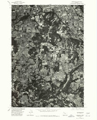
1975 Map of Damascus
USGS Topo · Published 1985About this map
Damascus and its surrounding agricultural landscape are captured in this 1975 orthophotomap, showing the rural character of Clackamas County before significant suburban expansion. The aerial perspective reveals a complex mosaic of timber stands, orchards, and open fields, particularly around the elevated terrain of Walters Hill. To the south, the Clackamas River carves a distinct path through the valley, serving as a primary geographical boundary. The image highlights the early development patterns of Boring in the east and the southern fringes of Gresham to the north. Produced by the Geological Survey in cooperation with the Soil Conservation Service, this document emphasizes the transition between forest and farm that defined this region of Oregon during the mid-1970s, providing an essential look at land use and property boundaries of the era.
Find a feature on this map
5 named features on this map. Tap any name to fly to it.
Don’t see what you’re looking for? This feature index may not catch every label — zoom into the map to look around manually.
Map Details
Editions of this 1975 Damascus Map
This is the sole edition of this map. No revisions or reprints were ever made.
Other maps of this area

1897 · Portland
USGS Topo · 1:62,500

1905 · Portland
USGS Topo · 1:62,500

1911 · Boring
USGS Topo · 1:48,000

1914 · Boring
USGS Topo · 1:62,500

1914 · Oregon City
USGS Topo · 1:62,500

1916 · Estacada
USGS Topo · 1:125,000

1918 · Troutdale
USGS Topo · 1:62,500

1934 · Troutdale
USGS Topo · 1:48,000

1939 · Oregon City
USGS Topo · 1:62,500

1940 · Boring
USGS Topo · 1:62,500