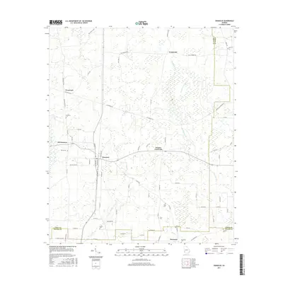
2017 Map of Damascus
USGS Topo · Published 2017About this map
Damascus sits at the heart of this southwest Georgia landscape, where the local road network converges around a grid including Railroad Ave and Bull St. The area's agricultural and rural character is defined by scattered hamlets and family-associated landmarks, including Old Damascus and Douglasville. Several small burying grounds, such as Billings Cem and Gordon Cem, are distributed throughout the countryside, offering valuable data points for genealogical researchers. The terrain is marked by the slow-moving waters of Big Cypress Creek and its many branches, while the jurisdictional boundaries between Early, Baker, and Miller Counties cut through the fields and wetlands. This modern survey illustrates the persistent importance of local thoroughfares like Old Damascus Rd and Five Bridges Rd in connecting these long-standing farming communities.
Find a feature on this map
76 named features on this map. Tap any name to fly to it.
Don’t see what you’re looking for? This feature index may not catch every label — zoom into the map to look around manually.
Map Details
Editions of this 2017 Damascus Map
This is the sole edition of this map. No revisions or reprints were ever made.
Other maps of this area

1953 · Dothan
USGS Topo · 1:250,000

1954 · Dothan
USGS Topo · 1:250,000

1955 · Dothan
USGS Topo · 1:250,000

1973 · Bancroft
USGS Topo · 1:24,000

1973 · Hentown
USGS Topo · 1:24,000

1974 · Donalsonville NE
USGS Topo · 1:24,000

1974 · Damascus
USGS Topo · 1:24,000

1974 · Arlington
USGS Topo · 1:24,000

1974 · Cooktown
USGS Topo · 1:24,000
1974 · Colquitt
USGS Topo · 1:24,000