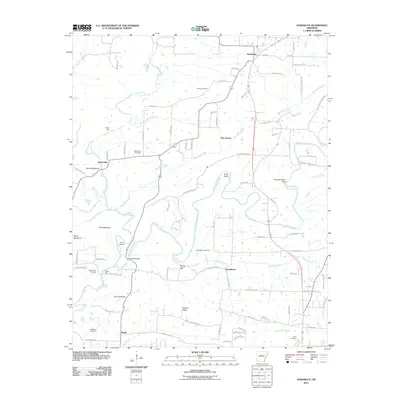
2011 Map of Damascus
USGS Topo · Published 2011About this map
Cadron Creek and Batesville Creek wind through this central Arkansas landscape, where small rural communities are connected by a network of winding roads like Old Hwy 65 and Solomon Grove Rd. The area is characterized by several distinct ridges and peaks, including Cove Mountain, Round Mountain, and the prominent Duncan Ridge, which dictate the local drainage patterns for tributaries like Shilling Branch and Peavine Creek. For those researching local heritage, the map reveals a high density of burial grounds such as Spires Cemetery, Martinville Cemetery, and Thorn Cemetery. Early transportation landmarks are also preserved on this sheet, including the Quinn Ford and Fishtrap Bridge along the waterway corridors. The proximity of settlements like Damascus, Twin Groves, and Republican highlights the persistent residential pattern of the region's foothills.
Find a feature on this map
91 named features on this map. Tap any name to fly to it.
Don’t see what you’re looking for? This feature index may not catch every label — zoom into the map to look around manually.
Map Details
Editions of this 2011 Damascus Map
This is the sole edition of this map. No revisions or reprints were ever made.
Other maps of this area

1892 · Morrillton
USGS Topo · 1:125,000

1894 · Morrillton
USGS Topo · 1:125,000

1956 · Russellville
USGS Topo · 1:250,000

1961 · Menifee
USGS Topo · 1:24,000

1961 · Conway
USGS Topo · 1:62,500

1961 · Bee Branch
USGS Topo · 1:62,500

1961 · Greenbrier
USGS Topo · 1:24,000

1961 · Bee Branch
USGS Topo · 1:24,000

1961 · Morganton
USGS Topo · 1:24,000

1961 · Damascus
USGS Topo · 1:24,000