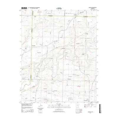
2014 Map of Damascus
USGS Topo · Published 2014About this map
The boundary between Van Buren and Faulkner Counties bisects the small community of Damascus, where residential lots cluster near the junction of Ar-285 and Ar-124. The landscape is defined by the winding course of Cadron Creek and its many tributaries, including Batesville Cr and Cove Creek. This terrain is punctuated by significant elevations like Roberts Mtn and Batesville Mtn, which overlook a network of rural settlements including Republican and Twin Groves. For those tracing local history, the map identifies several burial grounds such as Spires Cem, Martinville Cem, and the Republican Cemetery. Further south, the town of Greenbrier begins to emerge near Thorn Cem, while historical crossings like Fishtrap Bridge suggest the importance of the local waterways to the area's development and transport patterns in the early 21st century.
Find a feature on this map
105 named features on this map. Tap any name to fly to it.
Don’t see what you’re looking for? This feature index may not catch every label — zoom into the map to look around manually.
Map Details
Editions of this 2014 Damascus Map
This is the sole edition of this map. No revisions or reprints were ever made.
Other maps of this area

1892 · Morrillton
USGS Topo · 1:125,000

1894 · Morrillton
USGS Topo · 1:125,000

1956 · Russellville
USGS Topo · 1:250,000

1961 · Menifee
USGS Topo · 1:24,000

1961 · Conway
USGS Topo · 1:62,500

1961 · Bee Branch
USGS Topo · 1:62,500

1961 · Greenbrier
USGS Topo · 1:24,000

1961 · Bee Branch
USGS Topo · 1:24,000

1961 · Morganton
USGS Topo · 1:24,000

1961 · Damascus
USGS Topo · 1:24,000