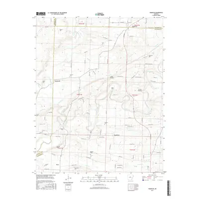
2017 Map of Damascus
USGS Topo · Published 2017About this map
The town of Damascus sits at the intersection of three counties, anchoring a landscape where the Arkansas Ozark foothills meet the Arkansas River Valley. This 2017 survey details a network of rural communities including Twin Groves, Republican, Martinville, and Bono, each connected by a winding system of roads like Scratch Gravel Rd and Old Hwy 65. The topography is defined by prominent elevations such as Batesville Mtn and Horseshoe Mtn, which direct the flow of Cove Creek and Cadron Creek. Local history is deeply embedded in the land, with numerous family and community burial grounds like Spires Cem, Mallet Town Cem, and Thorn Cem scattered across the quadrangle. A notable landmark, the Fishtrap Bridge, spans the waters where the terrain transitions toward Duncan Ridge.
Find a feature on this map
102 named features on this map. Tap any name to fly to it.
Don’t see what you’re looking for? This feature index may not catch every label — zoom into the map to look around manually.
Map Details
Editions of this 2017 Damascus Map
This is the sole edition of this map. No revisions or reprints were ever made.
Other maps of this area

1892 · Morrillton
USGS Topo · 1:125,000

1894 · Morrillton
USGS Topo · 1:125,000

1956 · Russellville
USGS Topo · 1:250,000

1961 · Menifee
USGS Topo · 1:24,000

1961 · Conway
USGS Topo · 1:62,500

1961 · Bee Branch
USGS Topo · 1:62,500

1961 · Greenbrier
USGS Topo · 1:24,000

1961 · Bee Branch
USGS Topo · 1:24,000

1961 · Morganton
USGS Topo · 1:24,000

1961 · Damascus
USGS Topo · 1:24,000