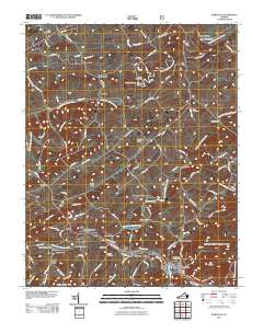
2011 Map of Damascus
USGS Topo · Published 2011About this map
The Middle Fork Holston River and South Fork Holston River converge within this corner of Washington County, shaping a landscape defined by river-bottom agriculture and small valley settlements. The town of Damascus serves as a primary hub in the south, while smaller crossroads like Lodi, Osceola, and Vestal anchor the surrounding rural tracts. The region’s historic reliance on water power is evident in the presence of De Busk Mill, Vails Mill, and Mock Mill, landmarks that reflect a long-standing milling tradition along the creeks.
Find a feature on this map
113 named features on this map. Tap any name to fly to it.
Don’t see what you’re looking for? This feature index may not catch every label — zoom into the map to look around manually.
Map Details
Editions of this 2011 Damascus Map
This is the sole edition of this map. No revisions or reprints were ever made.
Other maps of this area

1891 · Abingdon
USGS Topo · 1:125,000

1894 · Abingdon
USGS Topo · 1:125,000

1909 · Abingdon
USGS Topo · 1:96,000

1911 · Abingdon
USGS Topo · 1:125,000

1935 · Konnarock
USGS Topo · 1:24,000

1935 · Chilhowie
USGS Topo · 1:24,000
1935 · Abingdon
USGS Topo · 1:24,000

1935 · Grayson
USGS Topo · 1:24,000

1935 · Mount Rogers
USGS Topo · 1:48,000
1935 · Laurel Bloomery
USGS Topo · 1:24,000