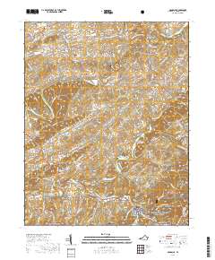
2019 Map of Damascus
USGS Topo · Published 2019About this map
The Middle Fork Holston River and South Fork Holston River converge their drainage basins in this section of Washington County, defining a landscape of narrow valleys and ridges. Modern Damascus sits at the southern edge of the sheet, serving as a hub where Laurel Creek meets the river. The map documents numerous small 19th and 20th-century settlements, such as Lodi, Osceola, and Roetown, many of which grew around mill sites and river crossings. Notable landmarks include the De Busk Mill and several river spans like Wright Bridge and Mast Bridge.
Find a feature on this map
131 named features on this map. Tap any name to fly to it.
Don’t see what you’re looking for? This feature index may not catch every label — zoom into the map to look around manually.
Map Details
Editions of this 2019 Damascus Map
This is the sole edition of this map. No revisions or reprints were ever made.
Other maps of this area

1891 · Abingdon
USGS Topo · 1:125,000

1894 · Abingdon
USGS Topo · 1:125,000

1909 · Abingdon
USGS Topo · 1:96,000

1911 · Abingdon
USGS Topo · 1:125,000

1935 · Konnarock
USGS Topo · 1:24,000

1935 · Chilhowie
USGS Topo · 1:24,000
1935 · Abingdon
USGS Topo · 1:24,000

1935 · Grayson
USGS Topo · 1:24,000

1935 · Mount Rogers
USGS Topo · 1:48,000
1935 · Laurel Bloomery
USGS Topo · 1:24,000