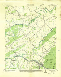
1935 Map of Damascus
USGS Topo · Published 1935About this map
South Fork Holston River and the Middle Fork Holston River dominate this 1935 Tennessee Valley Authority survey of Washington County. The landscape reflects a transition from river-valley agriculture to industrial power, notably at Edmondson Dam and the nearby Mocks Mill. Local community life is deeply etched into the topography through rural centers like Lodi and Vestal P O, alongside numerous landmarks such as Ebbing Springs Ch and Liberty Hall Sch.
Find a feature on this map
72 named features on this map. Tap any name to fly to it.
Don’t see what you’re looking for? This feature index may not catch every label — zoom into the map to look around manually.
Map Details
Editions of this 1935 Damascus Map
This is the sole edition of this map. No revisions or reprints were ever made.
Other maps of this area

1891 · Abingdon
USGS Topo · 1:125,000

1894 · Abingdon
USGS Topo · 1:125,000

1909 · Abingdon
USGS Topo · 1:96,000

1911 · Abingdon
USGS Topo · 1:125,000

1935 · Konnarock
USGS Topo · 1:24,000

1935 · Chilhowie
USGS Topo · 1:24,000
1935 · Abingdon
USGS Topo · 1:24,000

1935 · Grayson
USGS Topo · 1:24,000

1935 · Mount Rogers
USGS Topo · 1:48,000
1935 · Laurel Bloomery
USGS Topo · 1:24,000