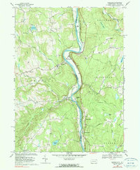
1968 Map of Damascus
USGS Topo · Published 1990About this map
The Delaware River carves a deep valley through this borderland, separating the township of Damascus in Pennsylvania from Cochecton in New York. The landscape is defined by the sharp meanders of the river, notably at Skinners Falls and around Big Island. On the New York shore, the Erie Lackawanna railroad follows the riverbank, connecting small sidings and stops like Smith Switch and the curiously named Nobody Station.
Find a feature on this map
51 named features on this map. Tap any name to fly to it.
Don’t see what you’re looking for? This feature index may not catch every label — zoom into the map to look around manually.
Map Details
Editions of this 1968 Damascus Map
2 editions found
Other maps of this area

1920 · Long Eddy
USGS Topo · 1:62,500

1920 · Damascus
USGS Topo · 1:62,500

1921 · Long Eddy
USGS Topo · 1:48,000

1921 · Livingston Manor
USGS Topo · 1:62,500

1922 · White Lake
USGS Topo · 1:62,500

1923 · Damascus
USGS Topo · 1:62,500

1923 · Long Eddy
USGS Topo · 1:62,500

1923 · Livingston Manor
USGS Topo · 1:62,500

1942 · White Lake
USGS Topo · 1:62,500

1943 · Honesdale
USGS Topo · 1:125,000