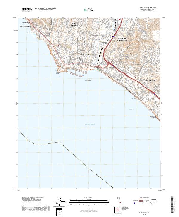
2022 Map of Dana Point
USGS Topo · Published 2022About this map
Laguna Beach and San Juan Capistrano anchor this 2022 survey of the Orange County coastline, documenting a densely populated corridor where suburban expansion meets the steep Pacific bluffs. The map illustrates the complex drainage systems that define the coastal shelf, including Arroyo Trabuco and San Juan Creek, alongside essential infrastructure like Cook Reservoir and Palisades Reservoir.
Find a feature on this map
46 named features on this map. Tap any name to fly to it.
Don’t see what you’re looking for? This feature index may not catch every label — zoom into the map to look around manually.
Map Details
Editions of this 2022 Dana Point Map
This is the sole edition of this map. No revisions or reprints were ever made.
Other maps of this area

1896 · Santa Ana
USGS Topo · 1:62,500

1901 · Southern California Sheet No. 1
USGS Topo · 1:250,000

1901 · Santa Ana
USGS Topo · 1:62,500

1902 · Capistrano
USGS Topo · 1:125,000

1902 · Corona
USGS Topo · 1:125,000

1904 · Southern California Sheet No. 2
USGS Topo · 1:250,000

1904 · Southern California Sheet No. 1
USGS Topo · 1:250,000

1906 · Capistrano
USGS Topo · 1:125,000

1942 · San Juan Capistrano
USGS Topo · 1:62,500
1942 · Santa Ana
USGS Topo · 1:62,500