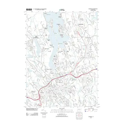
2012 Map of Danbury
USGS Topo · Published 2012About this map
Lake Candlewood dominates the northern landscape, its complex shoreline defined by numerous residential developments and points like Wildmans Landing and Candlewood Shores. This 2012 survey illustrates the transition from the lakeside communities of New Fairfield and Brookfield to the dense urban center of Danbury. The city's industrial and transportation history is anchored by the Danbury Railroad Museum and the Danbury Municipal Airport near the former Danbury Fairgrounds. Higher ground such as Bear Mountain and Beaver Brook Mountain provides contrast to the busy corridors of Germantown and Beaverbrook. Educational and civic life is centered around the campuses of Western Connecticut State University, while several burial grounds, including Wooster Cemetery and Saint Peters Cem, offer significant genealogical data for the region.
Find a feature on this map
410 named features on this map. Tap any name to fly to it.
Don’t see what you’re looking for? This feature index may not catch every label — zoom into the map to look around manually.
Map Details
Editions of this 2012 Danbury Map
This is the sole edition of this map. No revisions or reprints were ever made.
Other maps of this area

1892 · Danbury
USGS Topo · 1:62,500

1892 · New Milford
USGS Topo · 1:62,500

1892 · Carmel
USGS Topo · 1:62,500

1893 · Carmel
USGS Topo · 1:62,500

1893 · New Milford
USGS Topo · 1:62,500

1893 · Clove
USGS Topo · 1:62,500

1894 · Clove
USGS Topo · 1:62,500

1894 · Carmel
USGS Topo · 1:62,500

1898 · Clove
USGS Topo · 1:62,500

1901 · Clove
USGS Topo · 1:62,500