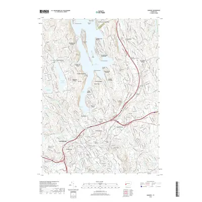
2018 Map of Danbury
USGS Topo · Published 2018About this map
Lake Candlewood and its complex shoreline dominate the northern landscape, where residential enclaves like Candlewood Isle and Candlewood Shores reflect the region's long-standing draw for lakeside living. To the south, the city of Danbury serves as a dense urban anchor, characterized by a concentration of civic and educational landmarks such as Western Connecticut State University and historical grounds like Wooster Cemetery. The map illustrates a high degree of development transition from the historic center of Brookfield Center to the newer neighborhoods of Hayestown and Germantown. Water management and transportation are central themes, seen in the Margerie Lake Reservoir and the convergence of I-84 and Us-7, which facilitate movement through the varied terrain between Beaver Brook Mountain and the Still River.
Find a feature on this map
103 named features on this map. Tap any name to fly to it.
Don’t see what you’re looking for? This feature index may not catch every label — zoom into the map to look around manually.
Map Details
Editions of this 2018 Danbury Map
This is the sole edition of this map. No revisions or reprints were ever made.
Other maps of this area

1892 · Danbury
USGS Topo · 1:62,500

1892 · New Milford
USGS Topo · 1:62,500

1892 · Carmel
USGS Topo · 1:62,500

1893 · Carmel
USGS Topo · 1:62,500

1893 · New Milford
USGS Topo · 1:62,500

1893 · Clove
USGS Topo · 1:62,500

1894 · Clove
USGS Topo · 1:62,500

1894 · Carmel
USGS Topo · 1:62,500

1898 · Clove
USGS Topo · 1:62,500

1901 · Clove
USGS Topo · 1:62,500