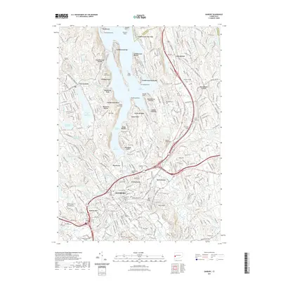
2021 Map of Danbury
USGS Topo · Published 2021About this map
Danbury serves as the focal point of this western Connecticut landscape, where the southern reaches of Candlewood Lake meet the city's expanding residential and institutional infrastructure. The map reveals a high density of local history markers, particularly the numerous cemeteries such as Wooster Cem, Saint Peter's Cem, and the United Jewish Center Cem near Brookfield. The terrain is defined by the sharp contrast between the industrial and transit corridor of the Danbury Branch railroad and the leisure-oriented shoreline communities of Candlewood Isle, Snug Harbor, and Candlewood Shores. Higher elevations like Bear Mtn and Huckleberry Hill overlook a complex network of waterways, including the Still River and several reservoirs that reflect the region's managed water resources.
Find a feature on this map
359 named features on this map. Tap any name to fly to it.
Don’t see what you’re looking for? This feature index may not catch every label — zoom into the map to look around manually.
Map Details
Editions of this 2021 Danbury Map
This is the sole edition of this map. No revisions or reprints were ever made.
Other maps of this area

1892 · Danbury
USGS Topo · 1:62,500

1892 · New Milford
USGS Topo · 1:62,500

1892 · Carmel
USGS Topo · 1:62,500

1893 · Carmel
USGS Topo · 1:62,500

1893 · New Milford
USGS Topo · 1:62,500

1893 · Clove
USGS Topo · 1:62,500

1894 · Clove
USGS Topo · 1:62,500

1894 · Carmel
USGS Topo · 1:62,500

1898 · Clove
USGS Topo · 1:62,500

1901 · Clove
USGS Topo · 1:62,500