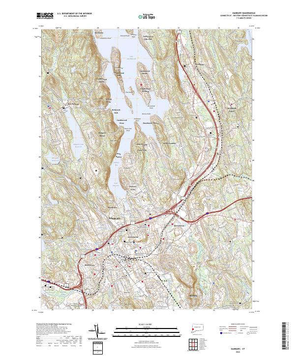
2024 Map of Danbury
USGS Topo · Published 2024About this map
Lake Candlewood dominates the northern landscape, its complex shoreline defined by numerous points and coves like Vaughns Neck and Snug Harbor. Residential developments such as Candlewood Knolls and Candlewood Isle ring the water, illustrating the area's transition into a major suburban and recreational hub. To the south, the urban center of Danbury is dense with local history, featuring neighborhoods like Germantown and Beckettsville alongside institutional landmarks like Western Connecticut State University.
Find a feature on this map
109 named features on this map. Tap any name to fly to it.
Don’t see what you’re looking for? This feature index may not catch every label — zoom into the map to look around manually.
Map Details
Editions of this 2024 Danbury Map
This is the sole edition of this map. No revisions or reprints were ever made.
Other maps of this area

1892 · Danbury
USGS Topo · 1:62,500

1892 · New Milford
USGS Topo · 1:62,500

1892 · Carmel
USGS Topo · 1:62,500

1893 · Carmel
USGS Topo · 1:62,500

1893 · New Milford
USGS Topo · 1:62,500

1893 · Clove
USGS Topo · 1:62,500

1894 · Clove
USGS Topo · 1:62,500

1894 · Carmel
USGS Topo · 1:62,500

1898 · Clove
USGS Topo · 1:62,500

1901 · Clove
USGS Topo · 1:62,500