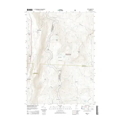
2015 Map of Danby
USGS Topo · Published 2015About this map
Otter Creek carves a narrow valley through the Green Mountains, defining the western corridor of this mountain landscape. In the mid-2010s, the settlements of Danby and Mount Tabor anchor the northern valley, while South End and North Dorset follow the drainage to the south. Genealogists can identify several historic burial grounds nestled at the base of the ridges, including Young Cem, Tabor Cem, and Mount Tabor Cem.
Find a feature on this map
58 named features on this map. Tap any name to fly to it.
Don’t see what you’re looking for? This feature index may not catch every label — zoom into the map to look around manually.
Map Details
Editions of this 2015 Danby Map
This is the sole edition of this map. No revisions or reprints were ever made.
Other maps of this area

1893 · Wallingford
USGS Topo · 1:62,500

1894 · Londonderry
USGS Topo · 1:62,500

1894 · Pawlet
USGS Topo · 1:62,500

1894 · Equinox
USGS Topo · 1:62,500

1896 · Equinox
USGS Topo · 1:62,500

1897 · Pawlet
USGS Topo · 1:62,500

1899 · Londonderry
USGS Topo · 1:62,500

1900 · Equinox
USGS Topo · 1:62,500

1903 · Mettawee
USGS Topo · 1:125,000

1950 · Glens Falls
USGS Topo · 1:250,000