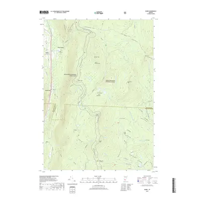
2018 Map of Danby
USGS Topo · Published 2018About this map
Mount Tabor and Danby serve as the primary valley settlements in this high-elevation landscape within the Green Mountain National Forest. The map documents a complex network of forest roads and trails, most notably a long stretch of the Appalachian National Scenic Trail as it traverses several prominent summits including Baker Peak, Peru Peak, and Styles Peak. The human footprint in the valley is centered around Otter Creek, where local family history is anchored by Young Cem and the Mount Tabor Cem. High-country features like Mad Tom Notch and the curiously named Little Michigan suggest the localized identities and pass-throughs established in these mountains. The terrain is marked by seasonal drainages such as Ten Kilns Brook and Mad Tom Brook, illustrating the drainage patterns that shaped the early logging and travel routes of the region.
Find a feature on this map
73 named features on this map. Tap any name to fly to it.
Don’t see what you’re looking for? This feature index may not catch every label — zoom into the map to look around manually.
Map Details
Editions of this 2018 Danby Map
This is the sole edition of this map. No revisions or reprints were ever made.
Other maps of this area

1893 · Wallingford
USGS Topo · 1:62,500

1894 · Londonderry
USGS Topo · 1:62,500

1894 · Pawlet
USGS Topo · 1:62,500

1894 · Equinox
USGS Topo · 1:62,500

1896 · Equinox
USGS Topo · 1:62,500

1897 · Pawlet
USGS Topo · 1:62,500

1899 · Londonderry
USGS Topo · 1:62,500

1900 · Equinox
USGS Topo · 1:62,500

1903 · Mettawee
USGS Topo · 1:125,000

1950 · Glens Falls
USGS Topo · 1:250,000