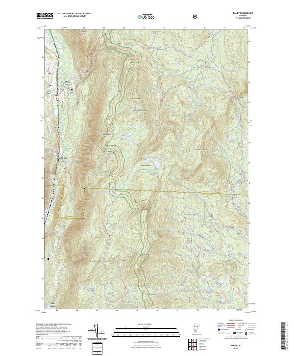
2024 Map of Danby
USGS Topo · Published 2024About this map
Otter Creek carves a narrow valley through the heart of the Green Mountains, anchoring the historical settlements of Danby and Mount Tabor. This modern survey reveals a landscape where valley-bottom agriculture and small-town footprints meet the steep, preserved expanses of the Green Mountain National Forest. High-elevation water bodies like Griffith Lake and Little-Mud Pond are tucked between prominent peaks such as Baker Peak and Styles Peak. The map documents a complex network of forest access and recreation, including the Appalachian National Scenic Trl and the Green Mountain Connector Trl, which navigate the rugged ridges. Small family and community cemeteries, including the Young Cem and Bowen Hill Cem, are preserved near the historic roads, offering tangible links for genealogists to the early families who settled this Rutland County corridor.
Find a feature on this map
77 named features on this map. Tap any name to fly to it.
Don’t see what you’re looking for? This feature index may not catch every label — zoom into the map to look around manually.
Map Details
Editions of this 2024 Danby Map
This is the sole edition of this map. No revisions or reprints were ever made.
Other maps of this area

1893 · Wallingford
USGS Topo · 1:62,500

1894 · Londonderry
USGS Topo · 1:62,500

1894 · Pawlet
USGS Topo · 1:62,500

1894 · Equinox
USGS Topo · 1:62,500

1896 · Equinox
USGS Topo · 1:62,500

1897 · Pawlet
USGS Topo · 1:62,500

1899 · Londonderry
USGS Topo · 1:62,500

1900 · Equinox
USGS Topo · 1:62,500

1903 · Mettawee
USGS Topo · 1:125,000

1950 · Glens Falls
USGS Topo · 1:250,000