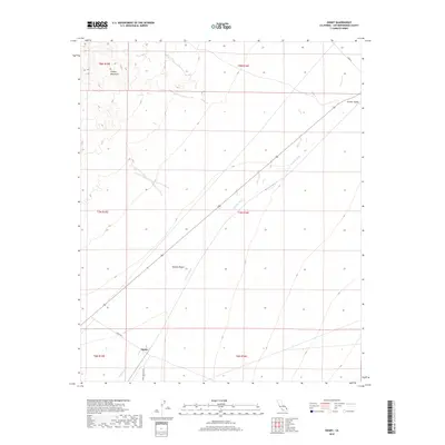
2018 Map of Danby
USGS Topo · Published 2018About this map
Danby sits at a crossroads of the high desert, serving as a focal point for this 2018 survey of the southeastern Mojave Desert. The landscape is defined by the significant drainage of Watson Wash, which cuts a diagonal path toward the settlement from the northeast. To the northwest, the Clipper Mountains rise sharply, providing a stark topographical contrast to the broad expanse of the Fenner Valley that occupies the upper right of the map. This area is characterized by its vast open space and a primitive road network that includes Danby Rd, Essex Rd, and Skeleton Pass Rd. These routes follow the natural contours of the desert floor, tracing ancient paths of travel through a region where water sources and elevation changes dictated the location of early outposts.
Find a feature on this map
14 named features on this map. Tap any name to fly to it.
Don’t see what you’re looking for? This feature index may not catch every label — zoom into the map to look around manually.
Map Details
Editions of this 2018 Danby Map
This is the sole edition of this map. No revisions or reprints were ever made.
Other maps of this area

1942 · Amboy
USGS Topo · 1:250,000

1943 · Amboy
USGS Topo · 1:250,000

1943 · Essex
USGS Topo · 1:62,500

1943 · Danby
USGS Topo · 1:62,500

1943 · Fenner
USGS Topo · 1:62,500

1954 · Needles
USGS Topo · 1:250,000

1956 · Needles
USGS Topo · 1:250,000

1956 · Fenner
USGS Topo · 1:62,500

1956 · Essex
USGS Topo · 1:62,500

1956 · Colton Well
USGS Topo · 1:62,500