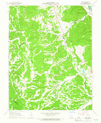
1964 Map of Danby
USGS Topo · Published 1965About this map
Danby sits at the heart of this mid-1960s landscape, where the rugged drainages of Isle du Bois Creek and Fourche a Du Clos carve through the borderlands of Ste. Genevieve and Jefferson counties. The settlement pattern is defined by family legacy and rural congregation, evidenced by the numerous burial grounds like Baker Cem and Hoover Cem, alongside the Lebanon Ch. The St Louis San Francisco railroad cuts a corridor through the northern hills, while smaller water features such as Skaggs Spring and Sunset Lake provided essential local resources. This survey captures a moment of transition for the region's industry, showing a small Quarry near the southeastern corner, while the complex system of hollows, including Hocum Hollow and Prentiss Hollow, reveals the area's difficult topography before modern development altered these deep-set drainage patterns.
Find a feature on this map
31 named features on this map. Tap any name to fly to it.
Don’t see what you’re looking for? This feature index may not catch every label — zoom into the map to look around manually.
Map Details
Editions of this 1964 Danby Map
2 editions found
Other maps of this area

1904 · Farmington
USGS Topo · 1:62,500

1906 · Farmington
USGS Topo · 1:62,500

1907 · Weingarten
USGS Topo · 1:62,500

1909 · Weingarten
USGS Topo · 1:62,500

1915 · Renault
USGS Topo · 1:62,500

1915 · Crystal City
USGS Topo · 1:62,500

1940 · Renault
USGS Topo · 1:62,500

1949 · Saint Louis
USGS Topo · 1:250,000

1949 · Rolla
USGS Topo · 1:250,000

1949 · Crystal City
USGS Topo · 1:62,500