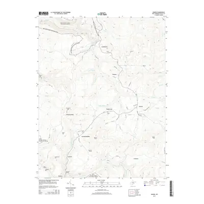
2014 Map of Danese
USGS Topo · Published 2014About this map
New River Gorge National River defines the western and northern edges of this high-plateau landscape, where the terrain falls away into the steep drainages of Manns Creek and Buffalo Creek. This mid-2010s survey shows a rural settlement pattern centered along WV-41, connecting small communities like Maplewood and Danese. The area's coal mining and timber history is subtly preserved in the network of county roads and named ridges like Walnut Ridge and Greenwood Mountain.
Find a feature on this map
75 named features on this map. Tap any name to fly to it.
Don’t see what you’re looking for? This feature index may not catch every label — zoom into the map to look around manually.
Map Details
Editions of this 2014 Danese Map
This is the sole edition of this map. No revisions or reprints were ever made.
Other maps of this area

1887 · Hinton
USGS Topo · 1:125,000

1889 · Nicholas
USGS Topo · 1:125,000

1891 · Nicholas
USGS Topo · 1:125,000

1891 · Raleigh
USGS Topo · 1:125,000

1892 · Hinton
USGS Topo · 1:125,000

1897 · Kanawha Falls
USGS Topo · 1:125,000

1897 · Raleigh
USGS Topo · 1:125,000

1900 · Kanawha Falls
USGS Topo · 1:125,000

1901 · Nicholas
USGS Topo · 1:125,000

1901 · Kanawha Falls
USGS Topo · 1:125,000