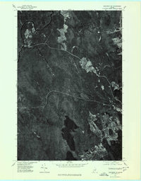
1975 Map of Danforth NW
USGS Topo · Published 1980About this map
Mattawamkeag River and Baskahegan Stream converge in this northern Maine landscape, defining the local hydrology and early settlement patterns around South Bancroft. The orthophoto detail from the mid-1970s reveals the intricate relationship between the water and the land, with clearings for agriculture and homesteads interspersed among the dense forest cover characteristic of Aroostook County. Significant water bodies like Lower Hot Brook Lake and Upper Hot Brook Lake occupy the southern portion of the quadrangle, flanked by topographic prominent points such as Snow Mountain and Jimmey Mountain. This specific survey period captures the region's rural character, showing the precise footprints of dwellings in Weston and the surrounding timberlands before modern reforestation or development shifted the visible boundaries of these small communities.
Find a feature on this map
8 named features on this map. Tap any name to fly to it.
Don’t see what you’re looking for? This feature index may not catch every label — zoom into the map to look around manually.
Map Details
Editions of this 1975 Danforth NW Map
This is the sole edition of this map. No revisions or reprints were ever made.
Other maps of this area

1940 · Danforth
USGS Topo · 1:62,500

1940 · Amity
USGS Topo · 1:62,500

1941 · Danforth
USGS Topo · 1:62,500

1941 · Amity
USGS Topo · 1:62,500

1941 · Mattawamkeag Lake
USGS Topo · 1:62,500

1941 · Wytopitlock
USGS Topo · 1:62,500

1943 · Danforth
USGS Topo · 1:62,500

1943 · Wytopitlock
USGS Topo · 1:62,500

1943 · Amity
USGS Topo · 1:62,500

1943 · Mattawamkeag Lake
USGS Topo · 1:62,500