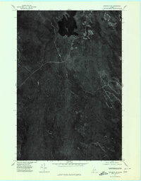
1975 Map of Danforth SW
USGS Topo · Published 1980About this map
Upper Hot Brook Lake and its surrounding Maine timberlands define this 1975 orthophotoquad, which captures the region's dense forest cover and hydrologic network through aerial imagery. The landscape is dominated by the prominence of Stetson Mountain in the southwest and the elevated terrain of Public Lot Ridge to the northeast. Between these heights, a series of watercourses drain the basin, including Hot Brook and the winding channels of the West Branch and East Branch. The imagery reveals a history of land management through the varied texture of the forest canopy, showing clearings and access roads that contrast with the dark, undisturbed water of the lake. This orthophoto provides a precise visual record of the wilderness and industrial logging footprint in Washington County before late-century changes in forest management.
Find a feature on this map
6 named features on this map. Tap any name to fly to it.
Don’t see what you’re looking for? This feature index may not catch every label — zoom into the map to look around manually.
Map Details
Editions of this 1975 Danforth SW Map
This is the sole edition of this map. No revisions or reprints were ever made.
Other maps of this area

1931 · Springfield
USGS Topo · 1:48,000

1934 · Springfield
USGS Topo · 1:62,500

1940 · Danforth
USGS Topo · 1:62,500

1941 · Danforth
USGS Topo · 1:62,500

1941 · Scraggly Lake
USGS Topo · 1:62,500

1941 · Wytopitlock
USGS Topo · 1:62,500

1943 · Danforth
USGS Topo · 1:62,500

1943 · Wytopitlock
USGS Topo · 1:62,500

1944 · Scraggly Lake
USGS Topo · 1:62,500

1954 · Millinocket
USGS Topo · 1:250,000