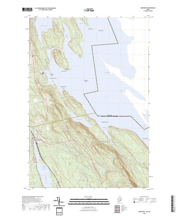
2024 Map of Danforth
USGS Topo · Published 2024About this map
Danforth sits at the junction of Baskahegan Stream and Crooked Brook Flowage, serving as a central hub for this borderland where the United States meets Canada. The landscape is dominated by a series of interconnected water bodies, including Grand Lake and Brackett Lake, which are punctuated by distinctive landmarks such as Whitehorse Reef and Norway Point. Settlement patterns are tightly linked to the local topography and historical transportation corridors, with names like Butterfield Landing Rd and Depot St hinting at the area's logistical importance.
Find a feature on this map
55 named features on this map. Tap any name to fly to it.
Don’t see what you’re looking for? This feature index may not catch every label — zoom into the map to look around manually.
Map Details
Editions of this 2024 Danforth Map
This is the sole edition of this map. No revisions or reprints were ever made.
Other maps of this area

1940 · Danforth
USGS Topo · 1:62,500

1940 · Amity
USGS Topo · 1:62,500

1940 · Forest
USGS Topo · 1:62,500

1941 · Danforth
USGS Topo · 1:62,500

1941 · Amity
USGS Topo · 1:62,500

1942 · Forest
USGS Topo · 1:62,500

1943 · Danforth
USGS Topo · 1:62,500

1943 · Amity
USGS Topo · 1:62,500

1957 · Fredericton
USGS Topo · 1:250,000
1958 · Danforth
USGS Topo · 1:62,500