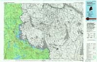
1994 Map of Danforth
USGS Topo · Published 1994About this map
The St Croix River and the sprawling waters of Spednic Lake form a jagged international boundary through this heavily forested region of Maine and New Brunswick. In the south, the Canadian Pacific railroad cuts through the landscape, linking the border town of Vanceboro to Danforth and Eaton. This area is defined by its massive water bodies, including Baskahegan Lake and Grand Lake, which dominate the low-lying terrain between prominent heights like Stetson Mountain and Tomah Mtn. Small, historic communities and land divisions such as Wilcox Settlement and Estabrook Settlement reflect the mid-century agricultural and timber patterns that persisted even as aerial photography updated the topographic record. The route of US Highway 1 serves as the primary north-south artery, connecting Haynesville and Weston across the rugged drainage of Sugar Ridge Brook.
Find a feature on this map
33 named features on this map. Tap any name to fly to it.
Don’t see what you’re looking for? This feature index may not catch every label — zoom into the map to look around manually.
Map Details
Editions of this 1994 Danforth Map
This is the sole edition of this map. No revisions or reprints were ever made.
Other maps of this area

1930 · Vanceboro
USGS Topo · 1:48,000

1931 · Springfield
USGS Topo · 1:48,000

1933 · Vanceboro
USGS Topo · 1:62,500

1934 · Springfield
USGS Topo · 1:62,500

1937 · Smyrna Mills
USGS Topo · 1:62,500

1938 · Houlton
USGS Topo · 1:62,500

1940 · Danforth
USGS Topo · 1:62,500

1940 · Amity
USGS Topo · 1:62,500

1940 · Waite
USGS Topo · 1:62,500

1940 · Forest
USGS Topo · 1:62,500