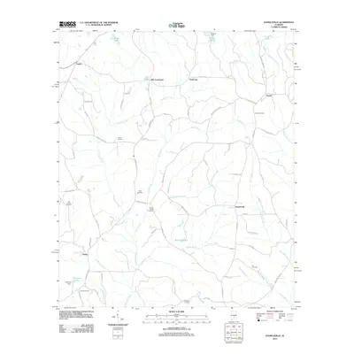
2011 Map of Danielsville
USGS Topo · Published 2011About this map
Danielsville serves as a central point in this rural landscape, where a network of family-named mill creeks and historic burying grounds defines the local geography. The drainage pattern of Stringer Mill Creek, Ryals Mill Creek, and Moseley Mill Creek suggests a history of water-powered industry that once supported small communities like Panola and Ellis Crossroads. Genealogists will find a high density of rural cemeteries, including Panola, Bethel, and King, scattered among the headwaters of Three Run Creek. The northern portion of the quadrangle is marked by Logan and the managed waters of Ryals Lake and Browns Lake, while the southern reaches transition into the lowlands of Beaver Branch. This terrain is tied together by historic transit corridors like Old Meriwether Trail and Fort Deposit Road, reflecting the enduring settlement patterns of Crenshaw County.
Find a feature on this map
78 named features on this map. Tap any name to fly to it.
Don’t see what you’re looking for? This feature index may not catch every label — zoom into the map to look around manually.
Map Details
Editions of this 2011 Danielsville Map
This is the sole edition of this map. No revisions or reprints were ever made.
Other maps of this area

1953 · Montgomery
USGS Topo · 1:250,000

1953 · Andalusia
USGS Topo · 1:250,000

1956 · Montgomery
USGS Topo · 1:250,000

1957 · Montgomery
USGS Topo · 1:250,000

1957 · Andalusia
USGS Topo · 1:250,000

1957 · Letohatchee
USGS Topo · 1:62,500

1971 · Fullers Crossroads
USGS Topo · 1:24,000

1971 · Fort Deposit
USGS Topo · 1:24,000

1971 · Honoraville
USGS Topo · 1:24,000

1971 · Greenville East
USGS Topo · 1:24,000