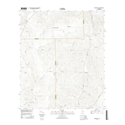
2014 Map of Danielsville
USGS Topo · Published 2014About this map
The boundary lines of Lowndes, Butler, and Crenshaw counties converge in this landscape of creek-fed hollows and rural settlements. The area is defined by its extensive network of watercourses, including the south-flowing Three Run Cr and Moseley Mill Cr, which drain the undulating terrain toward Little Patsaliga Cr. Scattered throughout this countryside are several family and community burial grounds, such as Oak Bowery Cem and King Cem, that serve as anchors for local genealogy. Small centers like Danielsville and Panola sit at the intersections of local routes like Fort Deposit Rd and Bowden Rd. The map also traces the path of Us-31 through Logan in the northwest, illustrating the transition from local farm roads to regional transit corridors.
Find a feature on this map
84 named features on this map. Tap any name to fly to it.
Don’t see what you’re looking for? This feature index may not catch every label — zoom into the map to look around manually.
Map Details
Editions of this 2014 Danielsville Map
This is the sole edition of this map. No revisions or reprints were ever made.
Other maps of this area

1953 · Montgomery
USGS Topo · 1:250,000

1953 · Andalusia
USGS Topo · 1:250,000

1956 · Montgomery
USGS Topo · 1:250,000

1957 · Montgomery
USGS Topo · 1:250,000

1957 · Andalusia
USGS Topo · 1:250,000

1957 · Letohatchee
USGS Topo · 1:62,500

1971 · Fullers Crossroads
USGS Topo · 1:24,000

1971 · Fort Deposit
USGS Topo · 1:24,000

1971 · Honoraville
USGS Topo · 1:24,000

1971 · Greenville East
USGS Topo · 1:24,000